
Field ControllersSOFTWARE
Nuwa
Android field survey software for GNSS and total station workflows.
Full-featured survey software for GNSS and total station data collection — topo, stakeout, road design, volume calculation.

Field survey software
Nuwa
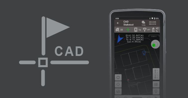
Supports direct import of various types of complex DWG and DXF files for staking of selected points and lines, as well as other more functions such as layer management, block operation, etc.
Technical
Specifications
| Platform | Android 10+ |
| Instruments | GNSS RTK, total station |
| Coordinate Systems | 4000+ built-in |
| Export | DXF, CSV, Shapefile, CASS |
Get Started
Ready to deploy Nuwa?
Talk to our team about pricing, integration, and support options.