
TS30
Visual & Laser GNSS Receiver combining RTK positioning, long-range laser measurement, point cloud visual positioning, TwinCam™ AR stakeout, and Global TAP Service in one compact field platform.
Laser & Vision GNSS Receiver
01
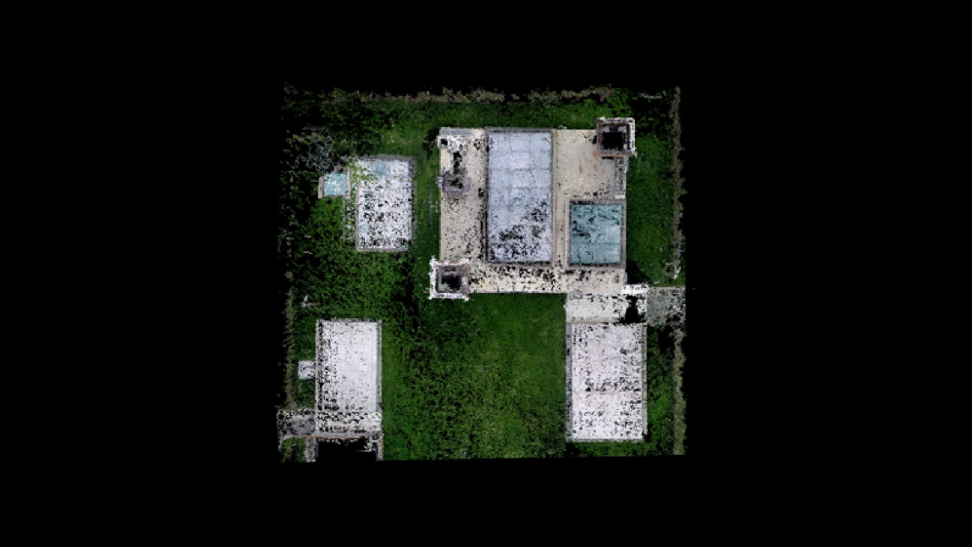
Capturing and Reconstructing the Site
With captuRTK™ TS30, simply walk through the site and record a video. The system automatically reconstructs high-density point clouds with accurate spatial positioning. Next, users can directly obtain coordinates, distances, angles, topographic maps, and generate DLG, DTM, DEM products.
- 0.05–50 m Laser range
- 8 mm distance accuracy
- Class 3R laser safety
- Red / green target marker alignment
- 3 cm Laser measurement accuracy within 10 m
02
Visual and Laser in one compact receiver
The front global shutter camera enables accurate visual positioning, while the integrated laser supports long-range measurement up to 50 m. Visual SLAM continuously tracks feature points to provide additional constraints for more reliable pose estimation and positioning performance.
- Generate a full 3D point cloud from a few minutes of video
- Capture color point clouds on site
- Measure distances, angles, and CAD drawings directly on the point cloud
- Reduce return visits when field details are missed
03
TwinCam™ AR Stakeout
TwinCam™ AR overlays targets and directional guidance onto live camera views, helping surveyors visually locate positions with less repeated pole adjustment and a more intuitive field workflow.
- Front and bottom camera support
- Live augmented view
- Target and directional overlay
- Faster visual point location
- Improved stakeout efficiency
04
24/7 Global TAP Service
Global TAP Service and TAP Fill support centimeter-level high precision when field teams work in areas without or with poor network coverage, helping keep measurement workflows stable across more sites.
- 24/7 Global TAP Service
- TAP Service and TAP Fill
- Centimeter-level support in poor coverage areas
- Better continuity for field workflows
Use Cases
Applications
Capture Reality, Measure Everything
Bring the site back to the office, no need for revisits and rework
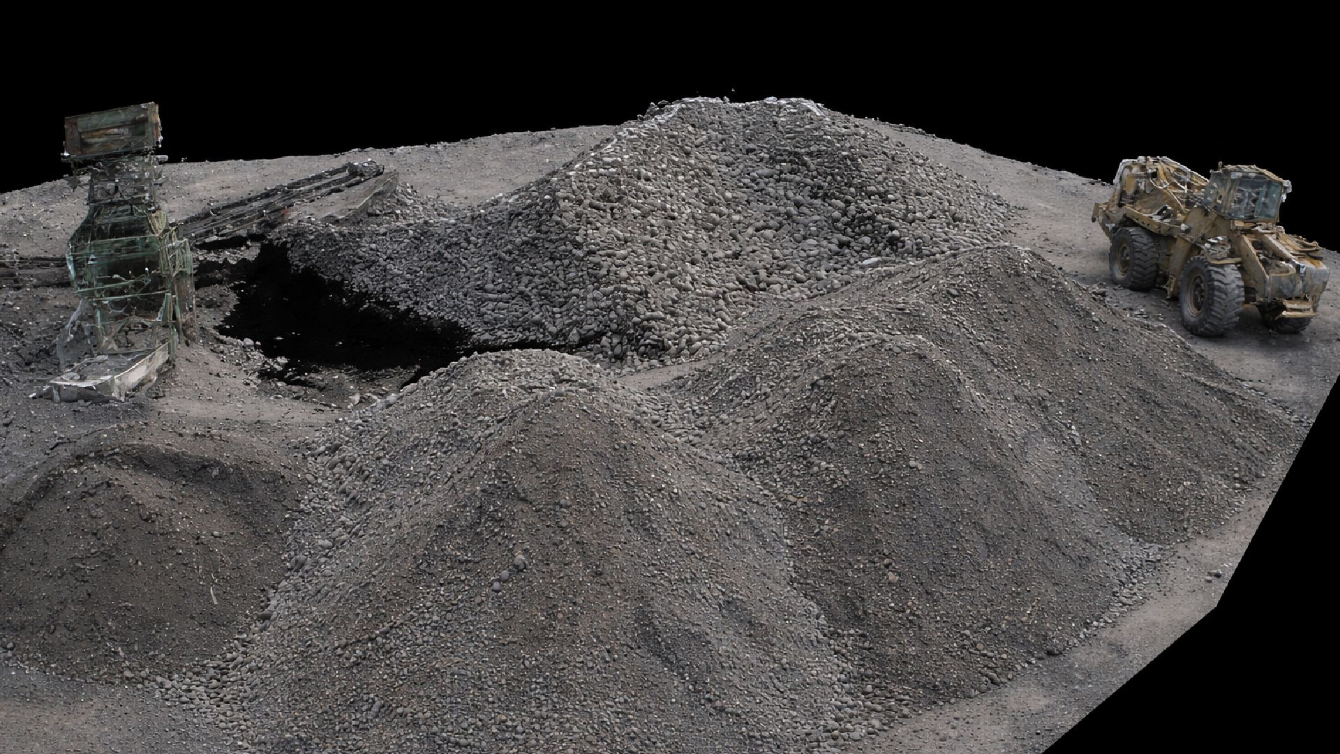
Earthwork & Volume Calculation
Generate point clouds on-site for terrain and stockpile calculation
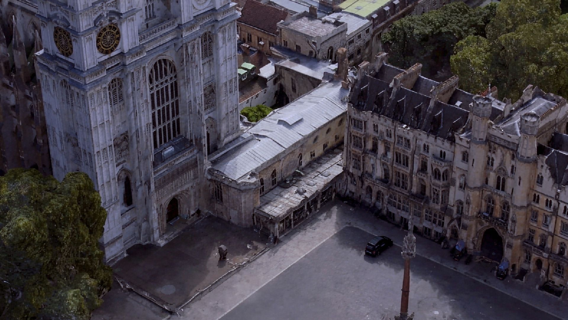
Distant Target Measurement
Measure inaccessible targets safely with visual and laser
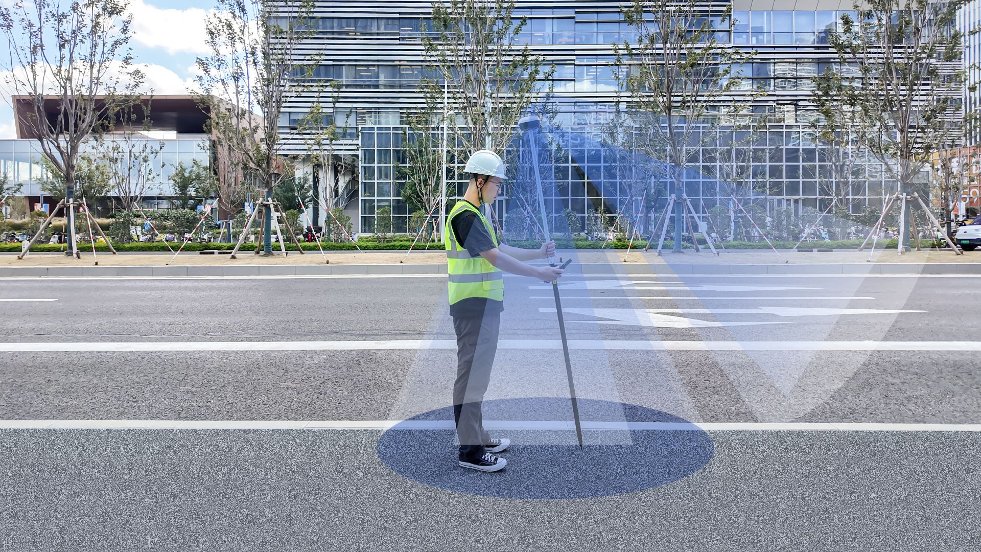
TwinCam™ AR Stakeout
Use live augmented camera guidance to visually locate points and reduce repeated pole adjustment.
Technical
Specifications
Support
Frequently Asked Questions
Get Started
Ready to deploy TS30?
Talk to our team about pricing, integration, and support options.