Visual positioning is the process of determining the position and orientation of a target in 3D space using image information acquired by a camera or other visual sensor. This is an essential function in applications such as navigation and extended realit
1. Definition of Visual Positioning
Visual positioning is the process of determining the position and orientation of a target in 3D space using image information acquired by a camera or other visual sensor. This is an essential function in applications such as navigation and extended reality experiences.
2. Core Concepts of Visual Positioning
Image Coordinate System
The image coordinate system refers to the coordinate system used to represent the position of the target in the image. Typically, the camera center serves as the origin. The horizontal coordinate denotes the number of columns, while the vertical coordinate denotes the number of rows.
3D Spatial Coordinate System
The 3D spatial coordinate system represents the position of the target in the actual scene. It is usually based on the world coordinate system and includes the x, y, and z axes.
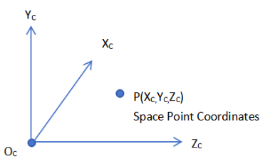
In-Camera Parameters
These parameters consist of focal length (f), principal point coordinates, etc. The relevance pertains solely to the camera itself and depends on its internal parameters.
Out-of-Camera Parameters
These parameters, such as the position vector and rotation matrix, describe the relationship between the camera and the world coordinate system. They are used to convert the 3D spatial coordinate system to the image coordinate system.
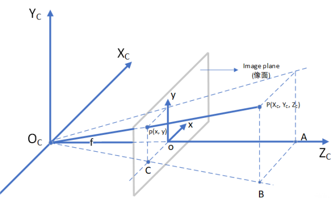
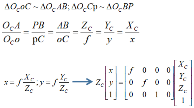
The conversion is based on the triangle similarity relationship.
3. Applying Visual Positioning to Surveying
The position, orientation, shape and size of an object can be reconstructed from images. The coordinates of object points, which are captured in images, can be obtained by applying visual positioning approaches without physical contact with the surveying device. The Tersus Oscar-Trek uses a GNSS+IMU system along with a camera and computer vision algorithms to estimate 3D position and attitude.
It enables precise remote point measurements by combining GNSS RTK with visual positioning directly in the field, providing globally referenced positions with centimeter-level accuracy.
Oscar Trek GNSS Receiver | Extreme RTK with Tilt Compensation and Photogrammetry (tersus-gnss.com)
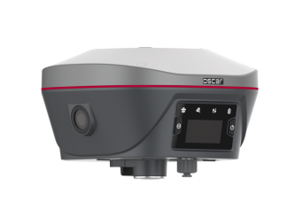
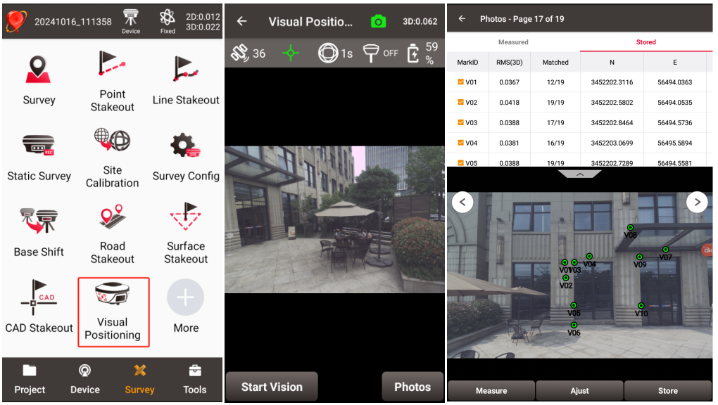
Utilizing the Visual Positioning feature in the Tersus NUWA app allows you to easily pick, check, adjust, and save data, thereby reducing the time spent on fieldwork and data processing.