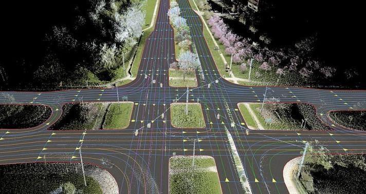
LiDAR (Light Detection and Ranging) is a very popular remote sensing technology in recent decades. It uses laser beams to detect and measure the distance of target objects without being affected by ambient light.
LiDAR (Light Detection and Ranging) is a very popular remote sensing technology in recent decades. It uses laser beams to detect and measure the distance of target objects without being affected by ambient light. The laser emitter emits laser light (mostly infrared light near the 905 nm band) to the object, then the laser receiver located inside the LiDAR module collects the light beam reflected by the target and differences in laser return times and wavelength carry information about the object to make a digital 3D representation of the target. Compared with traditional remote sensing technologies such as radar and sonar, LiDAR has deeply improved the precision of sensing. The laser precision of it can map features of an object or an environment as a point cloud that appears as solid physical objects on display.
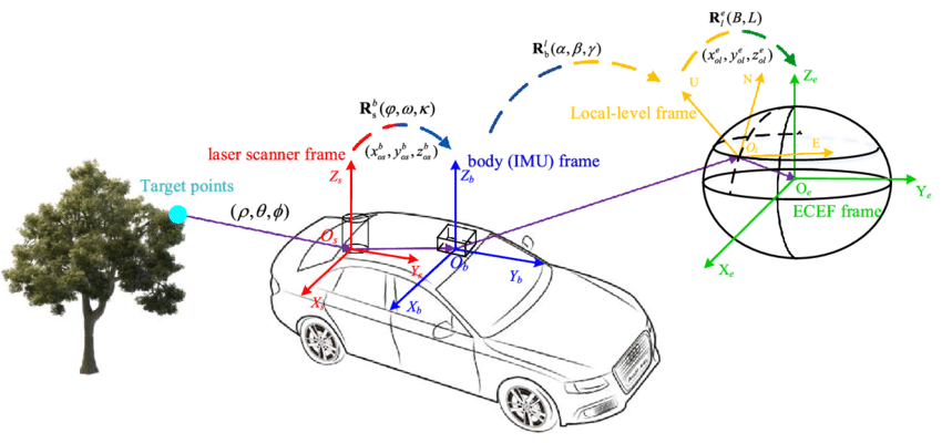
In the mapping and navigation application, the Laser Mapping system highly integrates three technologies: LiDAR, GNSS (Global Navigation Satellite System) and IMU (Inertial Measurement Unit). GNSS refers to a group of satellites which provide space signals, delivering positioning and timing information to the system. The Inertial Measurement Unit can measure both linear accelerations (three-axis accelerometer) and spin rates (three-axis gyroscope), which can be numerically integrated to provide the system's three-dimensional position and orientation. The point data obtained by the laser scanning independently are all based on the relative coordinate system with the laser as the origin. In the combination of the position data of the GNSS and the attitude data of the IMU, the point data obtained in the local frame can be transformed into the Earth-Centric-Earth-Fixed (ECEF) coordinate system. With the support of these two technologies, the laser scanning data can be ensured the correct geo-referenced 3D information.
At present, the mainstream technical route classification methods of lidar can be divided into classification according to ranging principle, scanning method, beam channel and load platform, etc. According to the principle of ranging, it can be divided into the time-of-flight method (TOF), continuous-pulse method and triangular ranging method. Among them, the TOF method, as a more mainstream ranging method, can be classified, according to the scanning method, into mechanical rotation type, Micro-electro-mechanical-system (MEMS) type Flash type and phased array lidar. According to the beam channel number, it can be divided into single-channel and multi-channel lidar. According to the load platform, it can be divided into airborne, vehicle, ground-based and spaceborne.
Among them, vehicle-mounted lidar is a mobile 3D laser measurement system, which is very popular in today's 3D information acquisition application for urban areas. In urban spaces with high building density and complex landforms, it breaks the limitations of traditional measurement methods and provides a rapid and more accurate measurement technology. Under the high integration of various sensors such as GNSS/IMU system, laser scanning system, control system, panoramic image system and odometer, data can be acquired and processed quickly, accurately, comprehensively and fully automatically, performing spatial geographic information more intuitive.