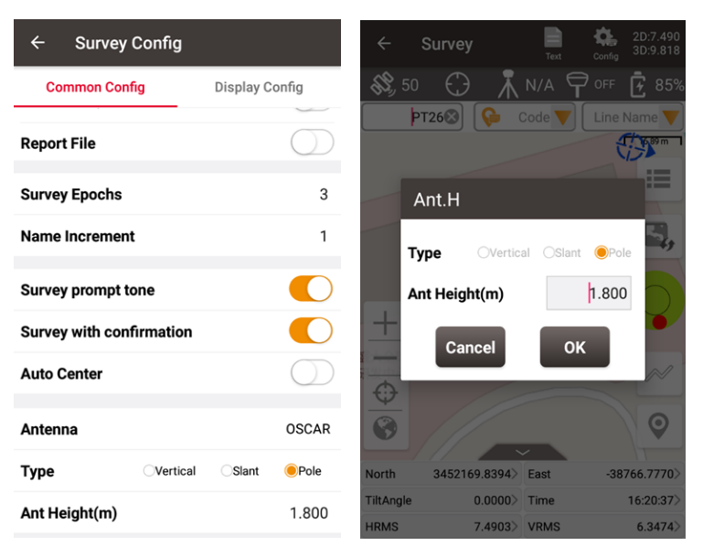
When various GNSS receivers receive high-precision data from the Global Navigation Satellite System (GNSS) for centimeter-to-millimeter-level positioning, which point coordinates are the positioning data we actually obtain? The point on the ground that the tip of the pole points to? Bottom point of receiver? Or the center point of the antenna? This article will briefly describe where the coordinates really located.
First of all, let's distinguish several commonly defined concepts:
● Marker: Ground reference mark, on which a tripod is erected or the antenna is directly fixed. It can also be considered as the ground target point to which the centering pole points.
● ARP: Antenna Reference Point, is the physical point on the antenna to which antenna calibration values are referenced. ARP is preferably an easily accessible point on the lowest non-removable horizontal surface of the antenna. Typically, the ARP coincides with the axis of attachment of the antenna to a monument or surveying instrument.
● APC: Antenna Phase Center, that is, the electrical center of the signal received by the antenna, and its spatial position is often not in the geometric center of the antenna. After the electromagnetic wave radiated by the antenna leaves the antenna for a certain distance, its isophase surface will approximate a spherical surface, and the spherical center of the spherical surface is the equivalent phase center of the antenna. The phase center is a theoretical point. In theory, the signal radiated by the antenna is centered on this point and radiates outward. This point is the so-called phase center.
● PCO: Antenna Phase Center Offset, the offset between the average phase center APC of the antenna and the antenna reference point ARP. The initial phase center offset (PCO) for a particular frequency, given in north-east-up components relative to the antenna reference point (ARP). PCO is considered the average point of signal reception if the satellite signal direction is not taken into account.
● PCV: The Phase Center Variation of the antenna, the difference between the instantaneous phase center and the average phase center of the antenna. Phase center variations (PCV) capture the component of an antenna calibration which depends upon the direction of the incoming signal. PCV may be provided as a function of elevation angle in the antenna frame (1D), or elevation and azimuth angle in antenna frame (2D). Like the PCO, the PCV is dependent upon the GNSS signal frequency.
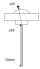
GNSS receiver actually measures the distance from the phase center of the satellite transmit antenna to the phase center of the receiver antenna. The coordinate measured by the receiver is actually the phase center coordinate of the receiver antenna, but this position is definitely not the coordinate position that the surveyor wants. So, we need to configure the antenna height or pole height parameters during measurement to calculate the actual coordinate position. coordinates of the target point.
In addition, the factory calibration value of the phase center of each antenna is different. Therefore, it is also necessary to select different antenna types to apply the corresponding correction model to fix the data results.
When using the controller software to connect the receiver, the corresponding antenna shall be correctly selected. The Tersus antennas in the antenna management list have been certified by NGS and the specifications can be viewed through the official NGS Antenna Calibrations (noaa.gov ) .
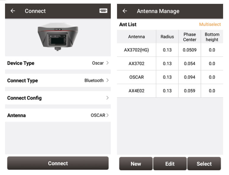
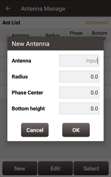
When using a split receiver which needs to connect an additional antenna, you can create, edit and select according to the specific antenna actually used.
Antenna height is critical when using a tripod for static measurements, as well as when using a pole for point and tilt measurements, precisely because it is an important parameter that affects the positioning algorithm to reduce the antenna phase center coordinates to the target point. When performing various measurement configurations, the NUWA software will pop up corresponding prompt boxes to set the antenna height.