

With TAP, we are confident in one thing: delivering high-precision positioning in the world through PPP. No base stations. No network dependency. Just one receiver providing centimeter-level results. But here is something we’ve learned over time: Getting “high-precision coordinates” is not the same as getting the “coordinates your client actually needs”.
Challenge
TAP outputs coordinates in ITRF2020 at real-time epoch. That is scientifically rigorous and globally consistent. However, most projects are not carried out in a global frame. They rely on national reference systems defined by specific frames, epochs, and sometimes velocity models.
And that is where questions begin. When we ask clients about their local datum — the reference frame, epoch, or deformation model — We often get silence. Not because they don’t care, but because in daily operations, people connect to CORS, check against control points, and rarely trace the geodetic foundation behind those numbers.
This was exactly the situation we walked into during our recent visit to Indonesia.
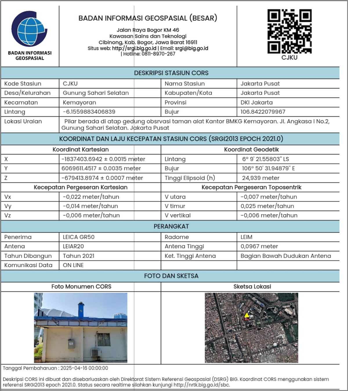
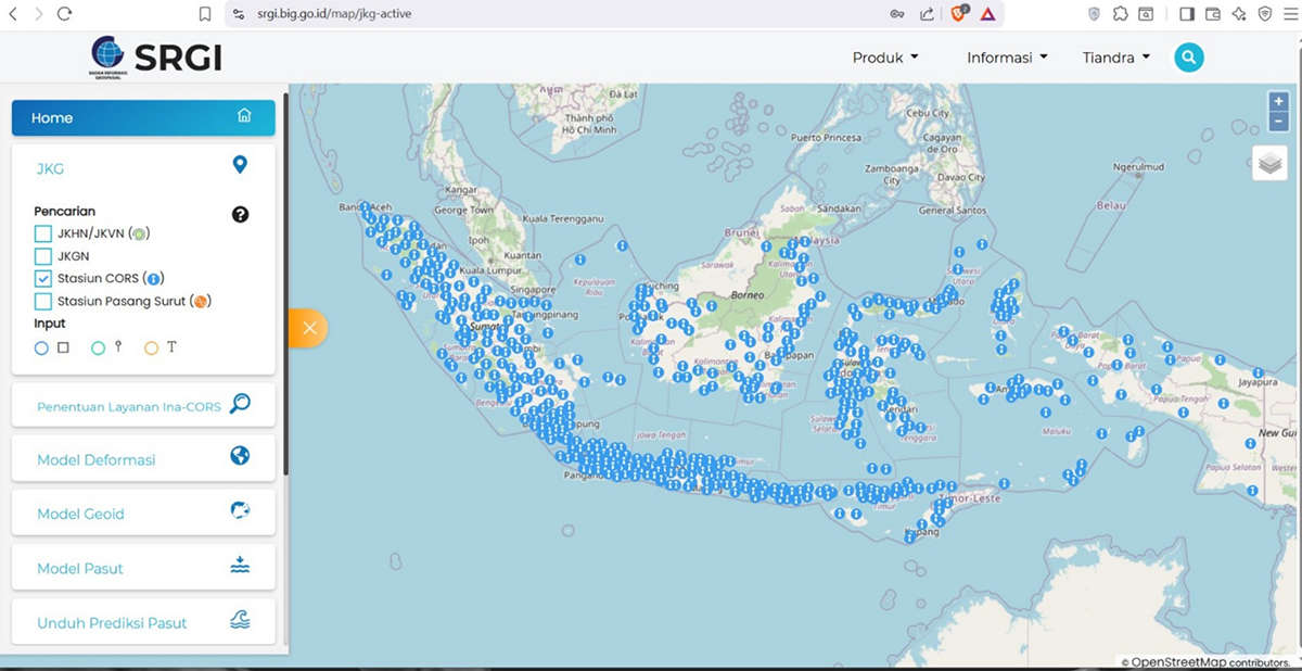
During our tests, we frequently connected to the local government CORS service – SRGI (Badan Informasi Geospasial, BIG). When we asked for control point coordinates to validate our RTK results, we found something remarkable:
✅ Control points came with full metadata – coordinates, epoch 2021.0, and even velocity fields for each station.
✅ On the SRGI website, we confirmed the frame: ITRF2014.
That was the missing puzzle piece! With this info, we could now confidently compare TAP coordinates against those from the BIG CORS network.
Solution
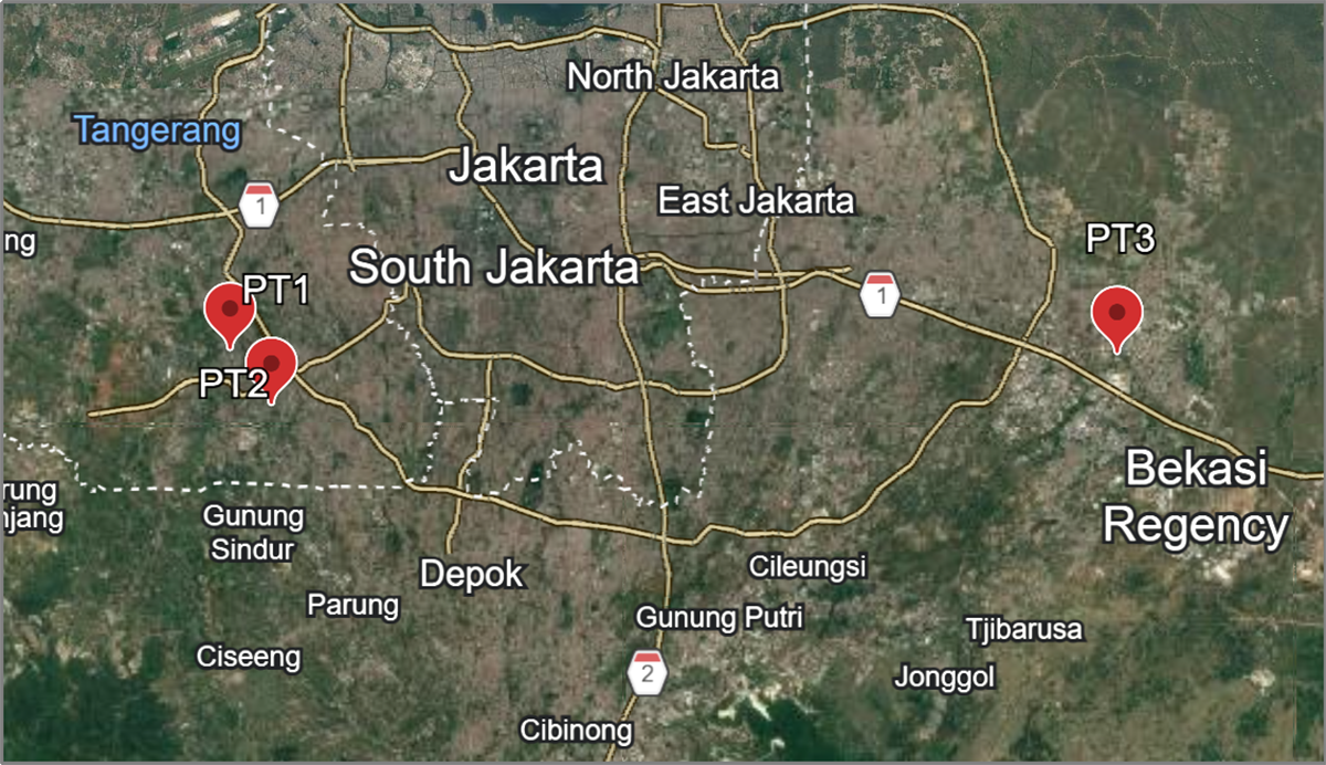
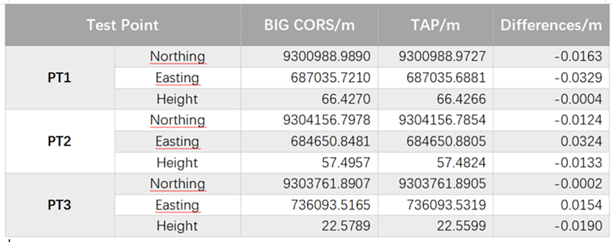
Round 1: Ground RTK Validation
We used LUKA-TAP at three different locations. After transforming TAP results into the BIG framework using the correct frame and epoch, the results aligned very well with the BIG coordinates.
It was a simple yet powerful confirmation: once you know the reference frame and epoch, high-precision global PPP can be aligned to local systems reliably.
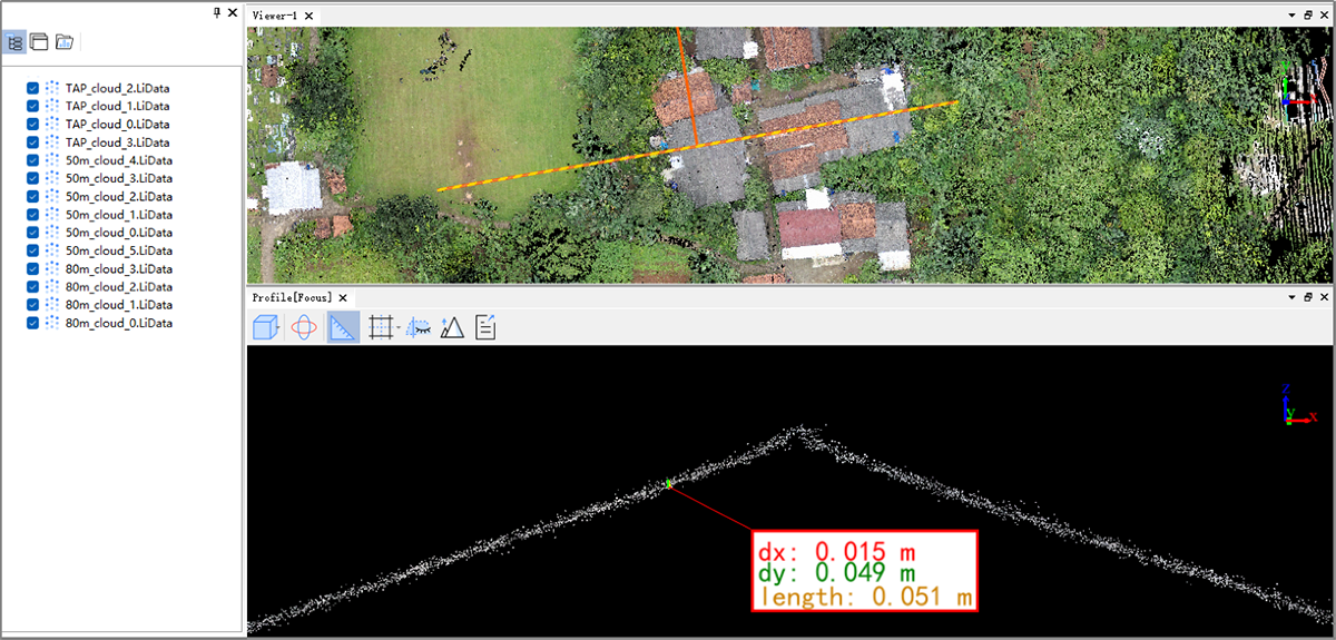
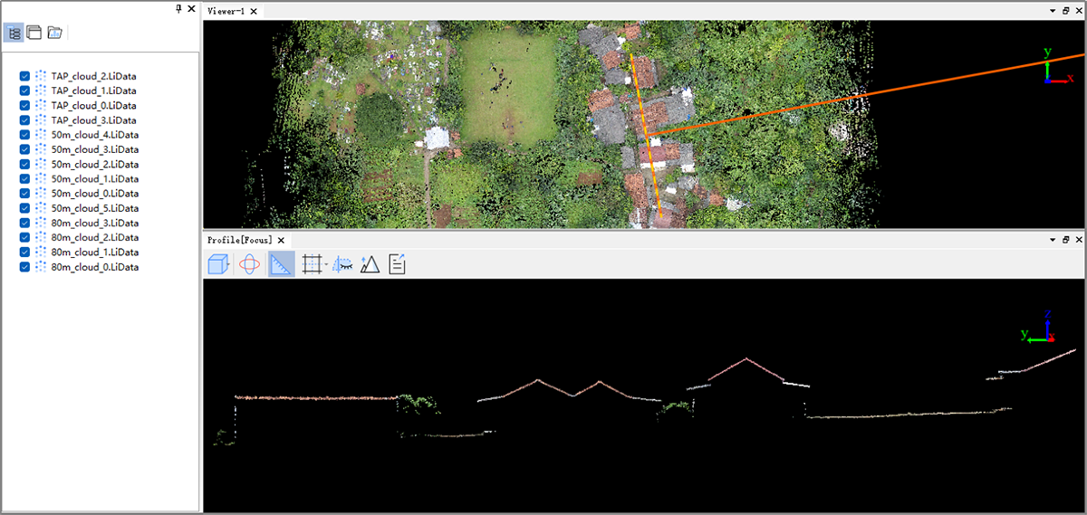
Round 2: Airborne LiDAR Comparison
Next, we tested MVP 100, our base-free airborne LiDAR. We flew at 50 m altitude, 4 m/s, while simultaneously logging raw data for PPK processing and running TAP for fixed solutions.
In post-processing: PPK mode: Imported base station data and used BIG CORS-derived coordinates as truth.
TAP mode: No base data imported. During TAP fitting, we entered the target parameters: ITRF2014, epoch 2021.0, and velocity fields from the control points.
The result? Point clouds from PPK and TAP aligned perfectly.
This confirmed that TAP, combined with the right frame and epoch information, can deliver local-aligned coordinates without needing a local base station.
Why This Matters
Indonesia has 475 CORS stations under BIG, covering the entire country. By integrating the reference frame and epoch into our software, and including the velocity field information for all 475 stations, we can enable fast TAP-to-local coordinate conversion. With just the software and your current position, the system can automatically populate all velocity field information for seamless alignment.
You might say, “CORS is already enough.” But
-If network coverage is weak
-If CORS is unavailable in remote areas
-If you operate offshore or airborne
You can still use TAP for high-precision global positioning, and align perfectly with Indonesia’s local BIG CORS system
Both RTK and TAP — why not choose it?
Results
Takeaway
High precision is mathematics. Alignment is understanding.
Indonesia reminded us that global PPP only becomes truly usable when the frame behind the coordinates is clear.
Once you know the frame, epoch, and velocity, TAP can confidently connect global positioning with national systems — solving real-world challenges together.
If you want to verify against control points, those control points must come from somewhere.
That “somewhere” reveals the reference frame. No control points? Then compare against CORS results. CORS always has a defined frame behind it.
No CORS either?
Then alignment becomes irrelevant.
In that case, TAP itself can become your primary reference, allowing you to establish a consistent local coordinate framework directly from it.